Untangling the Road Ahead
A closed road is easy to understand. The data describing it is not always so simple. With Gemini Enterprise Agent Platform, Waze found a faster way to interpret complex DATEX II feeds, turning weeks of specialised engineering work into minutes and helping partners get road disruption updates into Waze and Google Maps faster.
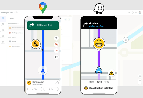
Road disruption data sounds simple at first. A road is closed. A lane is blocked. There are roadworks, flooding, an accident, or another event affecting traffic. That information needs to reach navigation platforms quickly, so drivers can be warned and routed around the disruption.
But behind that simple idea is a much more complicated data challenge. Different road authorities, municipalities, and mobility partners often describe disruptions in different ways: some use different systems; some follow the same standard, but implement it differently. And when the goal is to bring that information into Waze and Google Maps, consistency matters.
This is also where Waze for Cities plays an important role. The programme helps public agencies, road authorities, and mobility partners share authoritative road information, including closures, hazards, and traffic updates, with drivers across Waze and Google Maps. For that data to be useful at scale, it needs to move from partner systems into navigation experiences quickly, accurately, and reliably.
At Waze, Gemini was used in a focused, practical way: not to replace the existing data pipeline, but to remove one of the main bottlenecks—understanding how each partner represented road disruption data inside DATEX II.
DATEX II is more than a European standard for sharing traffic and road event information. It is central to road safety and real-time traffic information exchange under EU SRTI and RTTI regulations, supporting harmonised data sharing through National Access Points and related profiles. Its flexibility supports events from roadworks and closures to accidents, hazards, restrictions, and general road information.
That flexibility is useful for data providers. For downstream systems, however, it creates an information stream that cannot always be interpreted through a single deterministic set of rules.
One standard, many interpretations
The same real-world event can be represented in several valid ways. Location details, coordinates, directionality, affected lanes, time windows, and event metadata can all vary depending on how the feed was implemented.
Before this feature, onboarding a new DATEX II XML feed required the operations team to inspect the feed manually, understand how that partner structured the data, identify the relevant fields and configure custom logic so the feed could be transformed into the format Waze expects. In some cases, this took weeks of specialised engineering effort because DATEX II’s flexibility required feed-by-feed analysis, configuration and validation.
Waze needed a better way.
Why Gemini was the right fit
This was a good use case for Gemini because the problem was not simply converting one fixed schema into another. The challenge was interpretation: understanding how a specific partner used DATEX II, then turning that into a consistent Waze-ready structure.
For example, two partners may describe the same road closure but provide the geometry differently. One might include a polyline (an ordered collection of paths) in a dedicated field, while another might spread the same information across multiple fields. Both can be valid DATEX II implementations, but both need to become the same Waze-ready update structure.
Gemini helps bridge that gap. The feature analyses the incoming DATEX II XML feed, identifies how disruption information is represented and produces a converted feed file in the Waze structure. It supports key elements such as disruption type, location, start and end times, affected roads, directions, lanes, and partner-specific structures.
The breakthrough was not using Gemini to replace the existing pipeline; it was using Gemini where it made the most sense: the interpretation layer between flexible partner feeds and the consistent structure Waze needs.
From manual mapping to faster validation
With the Gemini-assisted workflow, feeds can be converted into the Waze structure within minutes, allowing the focus to shift to reviewing and validating the output. Instead of spending most of the effort on repetitive feed investigation, attention can be directed toward quality control, exceptions, and cases requiring human judgment. The feature was tested through an iterative, cross-functional framework designed to expedite feed onboarding while maintaining high levels of precision, combining prompt improvements, golden-set evaluation, and rigorous human validation.
A vital part of this human-in-the-loop validation was the Waze Map Editor community, a global network of dedicated volunteer experts who manually maintain and update the map. As the feature rolled out, editors helped validate that AI-interpreted closures reflected real-world conditions, preserving the local nuance needed to keep the map reliable.
It is a practical example of Waze operating at the intersection of people and technology: Gemini handles complex data translation at speed, while community expertise helps ensure the map remains trusted by drivers.
Initial launch results were promising: onboarding moved from weeks of specialised engineering effort to a streamlined process that can take minutes. The feature also had a substantial impact on processed feed coverage, translation accuracy and authoritative closure contributions. Most importantly, it increased Waze’s ability to turn partner-provided DATEX II feeds into reliable road closures across both Waze and Google Maps.
Practical technology, real impact
This Gemini use case solves a specific operational bottleneck: taking complex partner feeds and turning them into reliable updates that can help drivers.
While the feature was built around a Waze operational workflow, its impact is broader. Cleaner, faster and more reliable partner closure data strengthens the wider Google Geo ecosystem, helping road disruption information support navigation experiences across Waze and Google Maps.
For cities, that means authoritative closure data can reach drivers with less delay during roadworks, major events, emergency closures, and temporary restrictions. For drivers, it means better information, earlier.
When closure information moves faster and more reliably, everyone benefits: cities, partners, operations teams and, most importantly, drivers on the road.
Click here to read the article in its original format.
About the author
Daya Sherman, Product Manager, Google/Waze. Sherman focuses on leveraging advanced AI technologies to optimise real-time road data and navigation pipelines. With extensive experience in mobility systems and public agency partnerships, she works at the intersection of technology and community to deliver fast, reliable traffic updates to millions of drivers globally on Waze and Google Maps.